Aquatic Connectivity in the Little River Watershed
We are excited to announce that Little River Watershed Association has been granted funding through the US Fish and Wildlife Service’s National Fish Passage Program to find and inventory all aquatic barriers in the Little River Watershed.
What is an aquatic barrier?
An aquatic barrier is any obstacle that obstructs or disrupts the natural movement of water. Aquatic barriers restrict the movement of aquatic species like fish and macroinvertebrates through waterways. These barriers cause habitat fragmentation and prevent species from reaching spawning grounds or prevent their natural migration patterns.
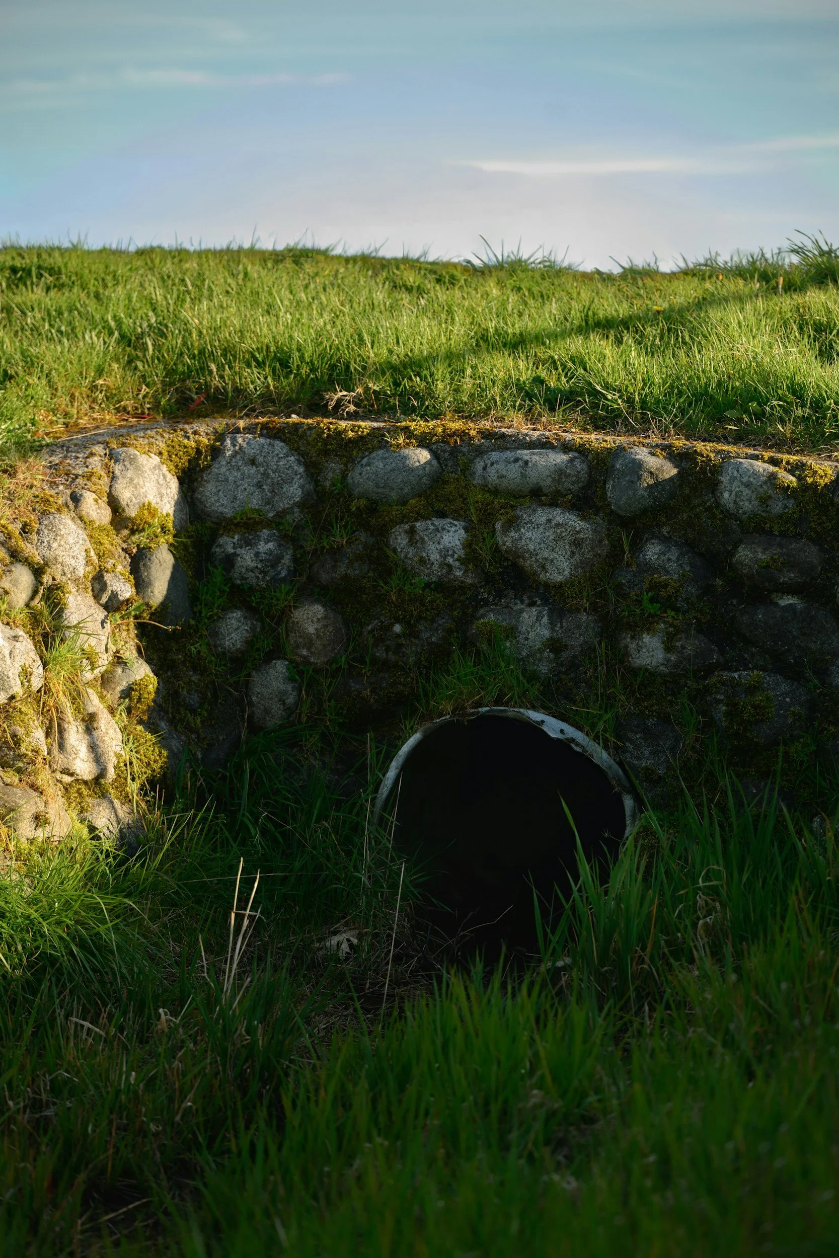
There are many kinds of aquatic barriers, both naturally occurring, like waterfalls, and man made. We are concerned about the man made aquatic barriers, because that is something we can mitigate and control. The most common in our watershed are low head dams, culverts (like pictured below), and road crossings.


Did you know some species of fish in East Tennessee such as small mouth bass migrate throughout the year? They prefer a certain temperature of water, so they move up river to cooler water in the summer when it is hot outside and down river to warmer water in the winter when it is cold outside.
Little River Watershed Association has been granted funding through the F25AS00282 National Fish Passage Program FY25 grant for a total inventory of aquatic barriers in the Little River Watershed (HUC 10 (0601020101)).
Our goal is to increase aquatic connectivity watershed wide.
The Little River is listed as an impaired river and improving aquatic connectivity in the watershed will help our water quality and biodiversity overall. Completing a total inventory of all aquatic barriers will guide us to assess and choose which barriers have the largest effect on our river system so they can be righted in the most effective and efficient order. According to the National Aquatic Connectivity’s National Aquatic Barrier Inventory tool there has been 190 of 2,162 structures in the area assessed.
95 of those are dams that were analyzed for impacts to aquatic connectivity and two have been removed to reconnect 62 miles of streams. LRWA wants to make an effort to inventory the remaining 1,972 barriers/structures. (Southeast Aquatic Resources Partnership) We will use the data collection protocol that the Southeast Aquatic Resources Partnership has adopted to ensure quality and accurate data collection as well as the ability to add our data collected to the National Aquatic Connectivity Collaborative’s Aquatic Barrier Inventory and Prioritization Tool. We will prioritize road crossings by largest running stream with greatest impact to smaller streams with less impact. Since a lot of these are right on/under roadways we can do year-round work with our AmeriCorps member. The project timeline spans from June 1, 2026, to September 1st, 2027. LRWA’s survey goal is to collect data on 500 undocumented crossings, which come out to about 7 sites per week. Training for these surveys should be no issue, a partner of LRWA in the area is able to train LRWA staff, volunteers, and AmeriCorps members to complete these surveys following the SARP protocol. This watershed hosts a rich biodiversity of species and would be benefited if we had complete aquatic connectivity. Some threatened or endangered species include: marbled darter (Etheostoma marmorpinnum) Critically Endangered and the sickle darter (Percina williamsi) Threatened. Additionally, according to a recent study published this year, Little River is home to a potentially endemic species of mussel Orangefoot Clubshell (Pleurobema parmaleei).(Schilling et al.).
Sources:
Schilling, Daniel E, et al. "Discovery of Cryptic Mussel Biodiversity in the Genera Pleurobema and Pleuronaia Using Molecular Phylogenetics and Morphology, with Descriptions of a New Species and a Previously Synonymized Species." Diversity, vol. 17, no. 10, 21 Oct. 2025, pp. 739, https://doi.org/10.3390/d17100739.
Tracy, Bryn H.; Rohde, Fred C.; and Hogue, Gabriela M. (2020) "An Annotated Atlas of the Freshwater Fishes of North Carolina," Southeastern Fishes Council Proceedings: No. 60. https://doi.org/10.7290/sfcp60gca7
Southeast Aquatic Resources Partnership. "National Aquatic Barrier Inventory." Aquaticbarriers.org, 225, aquaticbarriers.org/inventory/. Accessed 12 Dec. 2025.
So what is Little River Watershed Association doing?